Places of Interest |
|
Anuradhapura
- Urban Culture |
 |
Batticoloa :: Population : 99,000 :: Distance from : Colombo 303 km Batticoloa is surrounded by a large lagoon, home of the famous ‘singing fish’. Certainly in the months of April and September on moonlit nights, you can hear a musical vibration emanating from the waters. Batti is a quiet little place, with a small but well-preserved Dutch fort. |
 |
Colombo :: Population 700,000 :: Distance from Colombo International Airport 31km Colombo is a fascinating city, not only for its comfortable blend of East and West, but also for its cosy mixture of past and present. It is the commercial capital of the country. Attractions: Buddhist temples, Hindu temples, churches the old parliament building, the zoo, museums, and art galleries. |
 |
Dambulla
:: Population : 442,427 :: Distance from Colombo :148 km Like Sigiriya, Dambulla is a vast isolated rock mass, which houses a rock temple (formerly caves). Some of its frescoes are over 2,000 years old – and there is a colossal figure of the recumbent Buddha caved out of the rock, some 14 metres long. |
 |
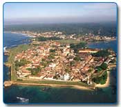
Galle :: Population : 97,000 :: Distance from Colombo 116km In this costal town, the Dutch presence is still visible. Galle was an ancient port (said to be the legendary Tarshish of the Bible), and our first international commerce and trade centre. Today, Galle is the bustling provincial capital and administrative centre of the south. It is famous for its lovely Unawatuna Bay, where the sea is reef protected and therefore safe for swimming. The old Dutch ‘Star’ fort (a World Heritages Site) covering 36 hectaers, the well-preserved Groote Kerk (Dutch Church), Dutch Government House, the New Oriental Hotel (built in 1684) old bell tower and a tide-based Sewage-System, also introduced by the Dutch. In Gale they still make the Dutch ‘pillo-lace’ and do fine ebony-carving and gem-polishing. |
 |
Hambantota :: Distance from Colombo 237km Hambantota, in Sri Lanka' dry zone, is best-known for its beautiful Crescent-shaped bay and its slat pans,a very ancient industry, that is still thriving. The slat pans line the main road for over 16km. |
 |
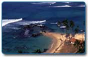
Hikkaduwa :: Population : 990,539 :: Distance from Colombo : 99km The first area to be developed for tourism, this is still one of the most popular of our beach resorts. Hikkaduwa is famous for its coral and sub tropical fish. The reef, which runs parallel to the shore and is only a few metres below the water, can be explored with snorkel and fippers, or in a glass-bottomed boat. There are several wrecks in the area which offer interesting dives. Scuba equipment and the services of licensed instructions are on hire from PADI centers. A little further down the coast, there’s good surf for board or body-surfing. There is a generally a community of international surfers in and around Hikkaduwa. |
 |
Jaffna
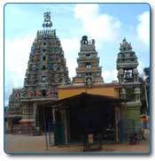
:: Population : 129,000 :: Distance from Colombo : 396km The peninsula is practically an island, connected the rest of Sri Lanka by a narrow spit of land which houses the Chundikkulam bird sanctuary and a causeway known as Elephant Pass because elephants would once cross the shallow lagoon at this point. Topographically quaint unlike the rest of lush Sri Lanka, only hard work and aggressive irrigation will coax a living out of this inhospitable northern soil. Jaffna is justly famous for the deliciousness of its mangoes and toddy from the palmyrah palm. There are plenty of beaches but no resorts. The Dutch ‘star’ fort in Jaffna is said to be Asia’s best example of Dutch fortification. Inside it are the King’s House and the Dutch Church. Since Jaffna’s population is predominantly Tamil, there are also many Hindu Kovils. |
 |
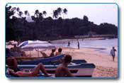
Kalutara :: Population 1,060,800 :: Distance from Colombo 42km More or less synonymous with rush and reed ware, (try to visit the permanent exhibition in the town’s Basket Hall), Kalutara was also a famous spice-centre in the 16th to 18th centuries. There are fine beaches safe for swimming . Immediately south of the Kalu Ganga Bridge on the main road is the Gangatil Vihara, which has a hollow dagoba (Buddhist shrine) with an interesting painted terior. By the roadside there’s a small shrine and the bodhi tree where drivers often stop to make offerings to ensure a safe journey to Wadduwa, 8km north of Kalutara. |
 |
Kandy
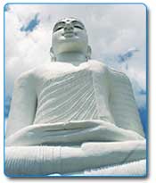
:: Population 147,000 :: Distance from Colombo 116 km Sri Lanka’s hill capital is, perhaps, its most beautiful town. It is 488 metres above sea level, and next to Colombo,Kandy is Sri Lanka’s most visited place. The focal point of the town is the golden-roofed Dalada Maligawa, where the sacred tooth relic of the Buddha is enshrined. The highlight of the year is the Esala Perahera, when a replica of the relic casket is taken in procession, accompanied by exotically costumed dancers, drummers and some 100 elephants ,on ten glittering nights in July/August. There are numerous shrines and temples in and around Kandy, where you will see rare paintings, frescoes, and stone carvings. Don’t miss the Paradeniya Gardens, with an amazing variety of trees, plants and flowers. Kandy is an exiting place for shopping, with souvenirs in wood, copper, silver, brass, ebony, and bronze. Ceramics, lacquer work, handlooms, batiks, jewellery and rush and reed-ware can also be purchased. |
 |
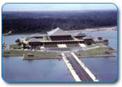
Kotte :: Population : 109,000 Kotte, renamed as Sri Jayawardenapura – Kotte is located 11km from Fort. Here, SriLanka’s new parliamentary complex and administrative capital was developed. It is surrounded by the water of Lake Diyawanna Oya. Kotte also had been a Capital City at the time of the arrival of Portuguese. |
 |
Kurunegala :: Population : 1,452,369 :: Distance from Colombo : 93 Now a thriving regional centre and the National Capital for a brief period centuries ago. Kurunegala also lies within the best coconut growing area or the so called Coconut Triangle. It is famous for the range of mountains (rocks) – Ethugala or the Elephant Rock, Ibbagala or Tortise rock jumbled with ruins of carved stairs and doorjambs, Andagala or Eel rock, Kuruminigala or Beatle rock, Wanduragala or Monkey rock and Elluwagala or Goat rock. |
 |
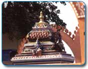
Manner :: Population : 19,000 :: Distance from Colombo : 312km The arid district of Manner, dotted with umbrella of thorn and baobab trees, lies in the northwest of the country. Manner Island is SriLanka’s largest, covering 130 sq kms and has one of the oldest ports in the country. The island is connected to the main land by a 3 km long causeway. Manner has a well preserved fort originally built by the Portuguese in 1560 and later improved by the Dutch. An important religious center “Tirukketishvaram Hindu Temple“ lies on the coast of the mainland, north of the causeway to Manner Island. Sight seeing includes – for the naturalists the baobab trees, introduced from Africa centuries ago by Arab traders are especially impressive. The Madhu Sanctuary, which is situated 40 km west of the town of Vavniya to the north of the main road to Manner, plays a major role for wild life lovers / naturalists. |
 |
Matara :: Population 761,236 :: Distance from Colombo : 160km 160 km from Colombo and is the end of southern railway line.There is long stretch of beach for holiday makers. Matara also has two excellent Dutch forts, the larger one contains much of old Matara including the excellent rest house which is said to be built on the site where captured elephants were corralled. The other fort, the small 1763 Star Fort, is now used as a library and has an attractive and unusual gateway. |
 |
Negombo :: Population : 2,066,096 :: Distance from Colombo : 37 km A characteristic fishing town 6 km from the International Airport, Negambo has a fascinating and picturesque beachfront. The town has several buildings dating back to the Dutch and Portuguese Colonial days. The lagoon is famous for its harvest of lobsters, crabs and prawns and fish auctions on the beach that are worth a look. |
 |
Nuwara Eliya |
 |
Polonnaruwa :: Population : 106,000 :: Distance from Colombo : 216 km The island’s medieval capital rose to fame after Anuradhapura’s decline. The largest of its many reservoirs, the Parakrama Samudra, is larger than the Colombo harbour. Attractions: Remains of the King’s council chamber, the Royal Citadel, the Kumara Pokuna, the Royal Pavilion, the Vatadage Relic House (which is lavished with moonstones, guard stones, and a sculptured railing), Kiri Vehera, and Gal Vihare. |
 |
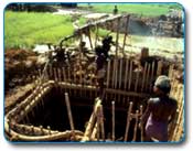
Ratnapura :: Population : 109,000 :: Distance from Colombo : 101 km Sri Lanka’s City of Gems’ and the centre of its gemming industry. Gems include sapphire, ruby, cat’s eye, alexandrite, topaz, amethyst, aquamarine, tourmaline, garnet and zircon. Visits to gem mines can be arranged through travel agents. Gem collections can be seen at the National Museum, Ratnapura, and a number of private museums. |
 |
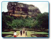
Sigiriya :: Population : 442,427 :: Distance from Colombo : 169 km This rock fortress was a royal citadel for more than 18 years. In a sheltered pocket, approached by a spiral stairway, are the famous frescoes. The summit of the rock, with an area of nearly one hectare, was the site of the old palace – the outer wall of which was built on the very brink of the precipice. The UNESCO-sponsored Central Cultural Fund has restored Sigiriya’s 5th century Water Gardens to its former glory. |
 |
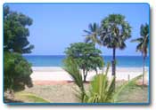
Trincomalee :: Population : 99,000 :: Distance from Colombo : 206 km The best known town on the east coast of Sri Lanka is Trincomalee. Sunny weather throughout the year; mile after mile of broad, white, sandy beaches, sheltered bays and a warm and calm sea are the features that draw sun and sea-lovers to Sri Lanka’s eastern seaboard’s main city. From time immemorial, Trincomalee’s main attraction, however, is a large, safe and one of the best natural harbours of the world. |
 |